Munger & Carlton Trails
Jay Cooke State Park, Carlton, MN
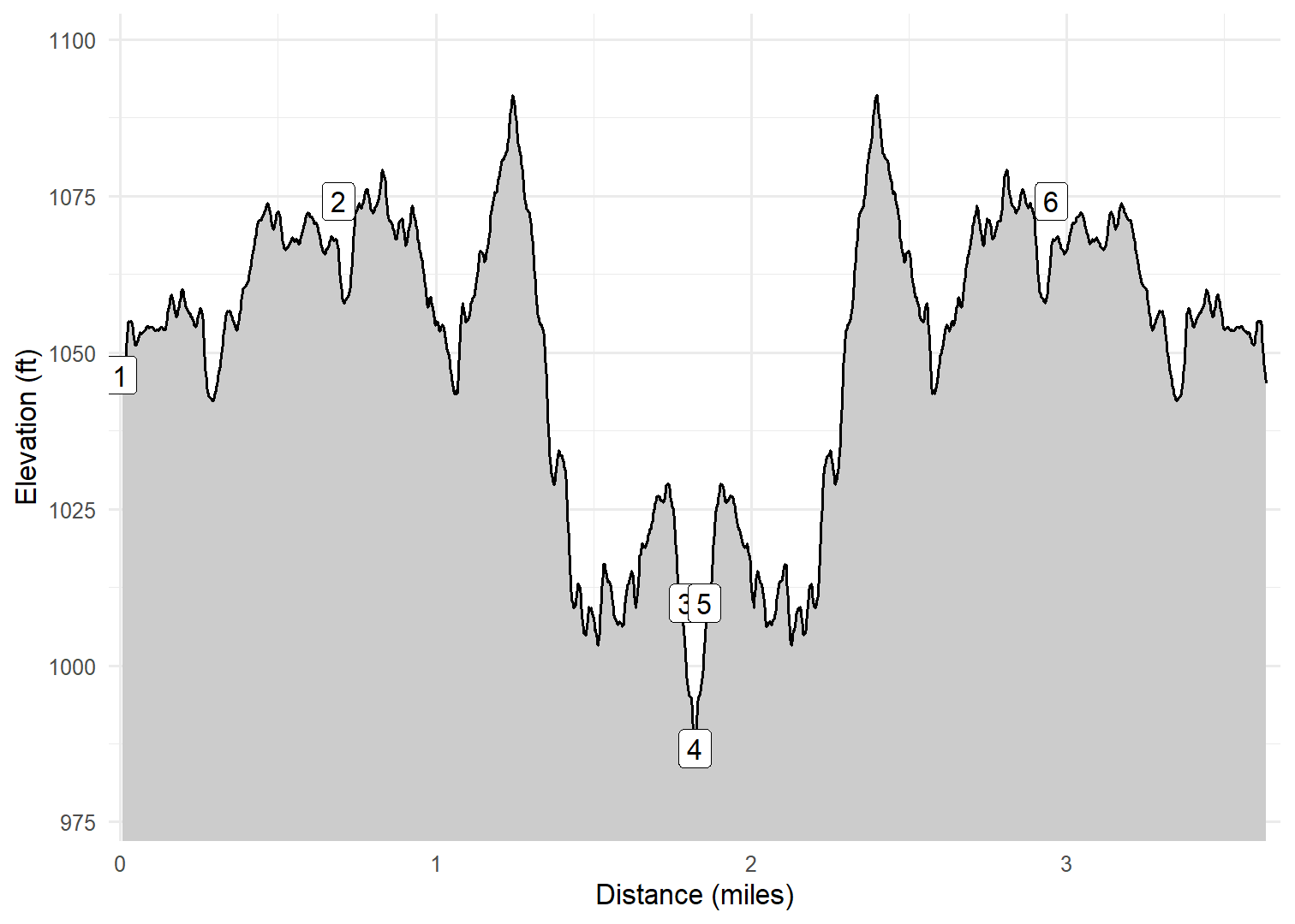
On April 14, 2024, Kim, Cash, and I made a quick hike on the Willard Munger State Trail near Jay Cooke State Park. The Munger Trail is a straight, flat, paved trail with a near bridge over the St. Louis River. Soon after the bridge, we left the Munger Trail on the Carlton Trail which generally follows along the St. Louis River. We did not have much time so we did a quick spur to the banks of the river and then followed the same trail back to the parking area. The trail along the river was very beautiful in places.
Walk-Specific Map
Take Note
- Click on a segment to get specific information.
- Numeric labels correspond to the same labels in the elevation profile and summary information below.
Elevation Profile
GPX Download
A sanitized GPX file of our hike is here.
Summary Information
| NUM | trackID | Primary | Description | Type | Distance | CumDist | DeltaElev |
|---|---|---|---|---|---|---|---|
| 1 | WMNGR50 | Willard Munger State Tr | Hwy 210 parking area to Carlton Tr | Trail | 0.69 | 0.69 | 28 |
| 2 | CARLTN01 | Carlton Tr | Munger Tr to Carlton Tr spur | Trail | 1.10 | 1.79 | -64 |
| 3 | CARLTN91 | Carlton Tr spur | Carlton Tr to St. Louis River | Trail | 0.03 | 1.82 | -23 |
| 4 | CARLTN91 | Carlton Tr spur | St. Louis River to Carlton Tr | Trail | 0.03 | 1.85 | 23 |
| 5 | CARLTN01 | Carlton Tr | Carlton Tr spur to Munger Tr | Trail | 1.10 | 2.95 | 64 |
| 6 | WMNGR50 | Willard Munger State Tr | Carlton Tr to Hwy 210 parking area | Trail | 0.69 | 3.64 | -28 |